Saturday, May 11, 2013

mystery

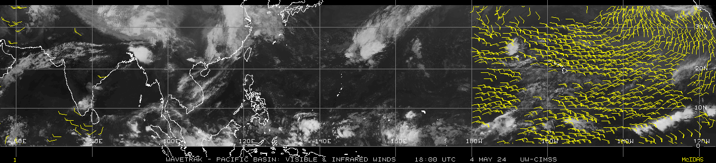
the track path of the cyclone still remains unpredictable..
The cyclone grows as of now towards the tamilnadu -andra border coasts
The conditions as of now is favorouble to drag the system towards indian coast
This conditions will stay as such until 72 hrs of the growth
Tomorrow by 5.30 pm IST we can get to know the systems recurves and leave the indian coast
We can hope that the fourable conditions will be there after 72HRS ie IST 5.30 pm to 8.30 pm(12/5/2013)
This 3 hours to the if the cyclone MAHESAN can grow in NW direction (10N82E) then the system is for indian coast.Then we are sure to get a mini MONSOON

Friday, May 10, 2013

Expected track of the cyclone


cyclone formation

latest update 01b


   DATE     TIME    LAT     LON    CLASSIFICATION   ID   NAME
 20130510   0830     5.3   -92.3     T2.0/2.0       01B  NONAME          
 20130510   0230     4.6   -93.7     T1.5/1.5       92B  92B             
 20130508   0830     5.8   -89.2     Too Weak       92B  92B             
 20130508   0230     5.8   -89.5     T1.0/1.0       92B  92B  

Thursday, May 9, 2013

latest uodate

Deviation expected to happen in coming cyclone......Westernghats i doubt no down pour


AS THE LATEST ECMWF IMAGES AND TRACK SHOWS THAT THE SYSTEM WILL MOVE TOWARDS ORISSA COAST AND MAY HIT THE ORISSA COAST ON 15TH OR 16 MAY.IT MAY RAIN IN TAMILNADU BUT NOT SURE LETS WAIT TILL 11TH TO UPDATE MORE

Wednesday, May 8, 2013

tpw


SSMI/SSMIS/TMI-derived Total Precipitable Water - Indian Ocean

Current time: Wed, 08 May 2013 15:03:33 GMT 


Animations: Recent FTP archive      |      Images: Recent / FTP archive      |      Product Description

new image

image for 91b

Home
IR w/ Low Level Winds - N/S Indian - Latest Available
Basins
Mouseover for list
Product
Info
Time Step
-6hr+6hr
IR Imagery
with Low Level Winds
850mb Vorticity

Address of direct link for this product :http://tropic.ssec.wisc.edu/real-time/wavetrak/windnpac.gifwavetrak/windspac.gif
North : 5-Day Movies:      FLASH
South : 5-Day Movies:      FLASH
    
North : 10-Day Movies:      FLASH
South : 10-Day Movies:      FLASH

Valid HTML 4.01 Transitional

update on the LLLC

The cyclonic formation over the bay of bengal is at a stationary stage as of now.But in next 24 hours it will attain a well defined structure.lets hope the depression moves northwest towards the coast of tamilnadu.

Monday, May 6, 2013

Depression 91B

A new uac formed over the bay of bengal will make over itself to a cyclone....The predicted projected path of this system is likely to be along the north tamilnadu coasts..If the cyclone hits the tamilnadu coast then it may pour a randsome amount of rains for the western ghats...It will be a great help for the cardamom planters to start their season earlier.